Airspace cleared & site logistics coordinated.
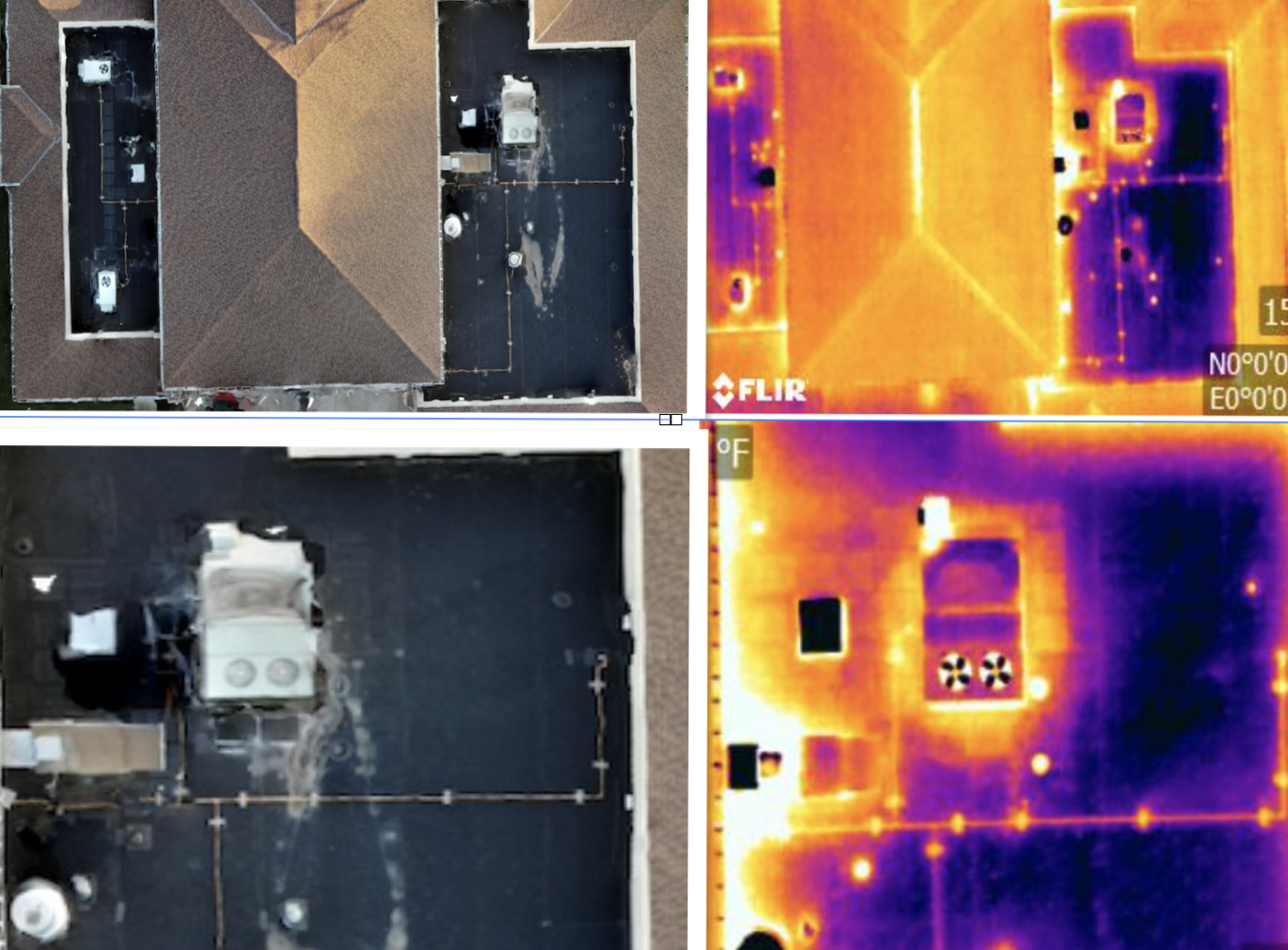
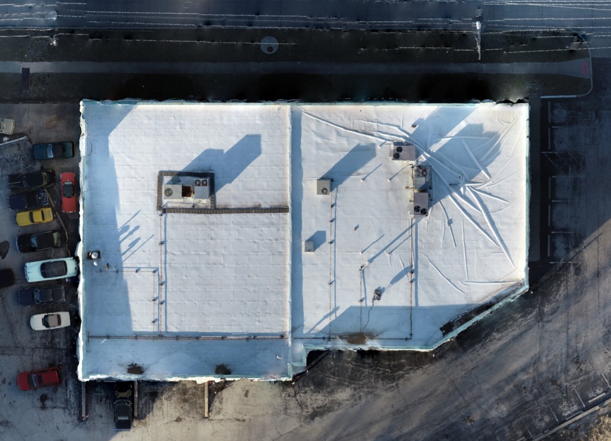
Aerial thermal + high-resolution photos with full-roof coverage.
ITC-certified review, validated against environment.
Orthomosaic + GPS hotspots, ready for precise repairs.
Claim-ready presentation of anomalies with callouts.
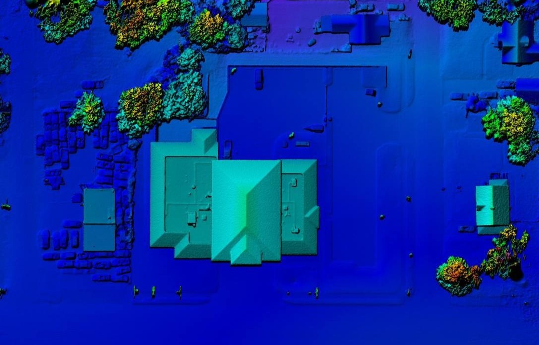
Elevation/DEM and orthophotos used to validate thermal findings and drainage patterns.
No ladders or fall hazards—keep teams safe.
Targeted fixes beat full replacements.
Objective data for budgeting and capital planning.